Rain and high wind return to Santa Cruz County this week. (Stephen Baxter — Santa Cruz Local)
Santa Cruz weather forecast
- Wednesday: Rain after 4 p.m. High of 56.
- Thursday: Rain before 10 a.m. then showers and southwest wind 25-45 mph. High wind watch, flood watch, high surf warning. High of 60.
- Friday: Rain before 10 a.m. West northwest wind 9-22 mph. High of 56.
- Saturday: Partly sunny, high of 60.
- Sunday: Mostly cloudy with a chance of rain, high of 62.
- Monday: Partly sunny, high of 61.
Source: National Weather Service
Update at 1:40 p.m. Thursday: Find evacuation warnings and evacuation orders on Santa Cruz County’s Zonehaven map.
SANTA CRUZ >> Strong wind and heavy rain are expected to blow through Santa Cruz County from late afternoon Wednesday through Friday morning.
A flood watch begins Wednesday night for Santa Cruz County, according to the National Weather Service. A high wind warning starts Thursday morning, followed by a high surf warning Thursday afternoon through Saturday morning.
“It’s definitely a storm to take notice of,” said Rachel Kennedy, a meteorologist with the National Weather Service. “If you live near a river or a creek, make sure you stay up to date on the forecast. Keep an eye on how things are evolving as we move through the storm.”
- Most areas of the Santa Cruz Mountains are expected to receive 3-5 inches of rain, with up to 6 inches of rain in some areas through Friday.
- Coastal areas are due 2-3 inches of rain through Friday.
- The bulk of the rain is expected late Wednesday and early Thursday.
- Gusts up to 60 mph are possible in the mountains and along the coast.
“Prepare for power outages, travel impacts, and localized flooding,” a CruzAware text alert stated Wednesday. “Please review your family preparedness plans, charge any communications devices, secure items on your property for wind impacts and follow local news for updates.”

A map shows up to 6 inches of rain in the Santa Cruz Mountains through Friday, Feb. 14. (National Weather Service)
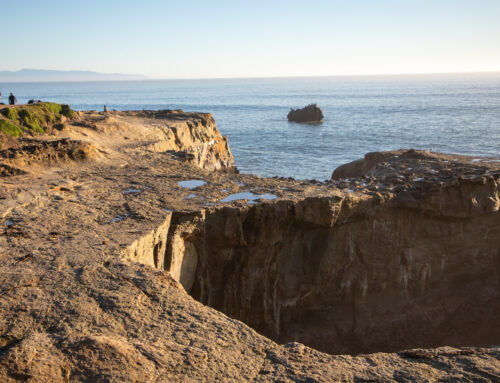
With soils already saturated from rain this month, landslides and falling trees are likely, increasing the chance of power outages, authorities said. Mountain residents are advised to prepare for blocked roads.
A flood watch is in effect Wednesday night through Saturday morning. Residents near rivers and creeks or in flood-prone areas should be prepared for potential flooding, authorities said.
Home and business owners should consider putting outdoor items inside or staking them down. Sandbags are recommended in flood prone areas.
“Today is when you should be getting those preparations done,” Kennedy said Wednesday.

Southwest wind gusts up to 60 mph are anticipated Thursday morning through Friday morning. (National Weather Service)
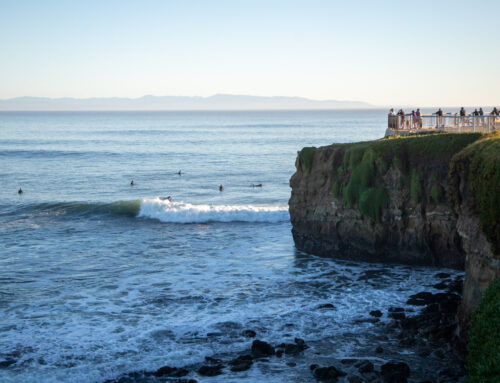
High surf is expected to peak Friday morning. A high tide of 5 feet is due about 11 a.m.
Residents are advised to avoid beaches, jetties and docks and never turn their back on the ocean.
A west swell of 18 feet at 15 second intervals is expected Friday, bringing waves of 10 to 15 feet to places like Steamer Lane in Santa Cruz, according to Surfline.com. West-northwest wind around 13 mph is expected. Smaller waves are anticipated Saturday and Sunday.

A west swell of 18 feet at 15 second intervals is expected to peak Friday morning. (National Weather Service)
More winter storm information
Questions or comments? Email [email protected]. Santa Cruz Local is supported by members, major donors, sponsors and grants for the general support of our newsroom. Our news judgments are made independently and not on the basis of donor support. Learn more about Santa Cruz Local and how we are funded.

Nik Altenberg is a bilingual reporter and assistant editor at Santa Cruz Local. Nik Altenberg es reportera bilingüe y editora asistente para Santa Cruz Local.