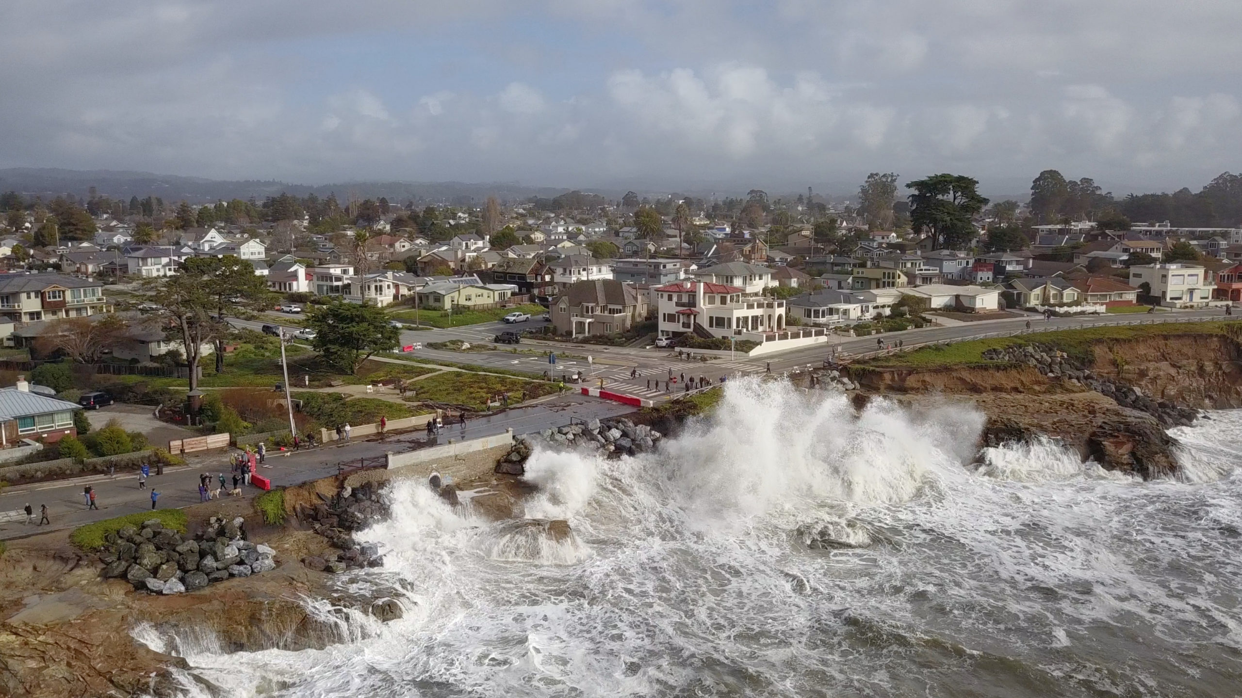
Waves slam West Cliff Drive near Woodrow Avenue in January. A culvert at Bethany Curve just west of Woodrow was damaged and has prompted West Cliff Drive to remain closed to drivers in that area through April. (TR Dreszer)
SANTA CRUZ >> In the wake of storms and heavy surf that sent parts of the West Cliff Drive bike path into the ocean this winter, city leaders on Thursday began a series of public meetings to address repairs and plan for West Cliff’s future.
“We’re here because we’re stewards of this iconic recreation area known both locally and in the world,” Santa Cruz City Manager Matt Huffaker said at the meeting at London Nelson Community Center. “This latest round of storms showed how vulnerable West Cliff is. Now is the time to protect it,” he said.
City leaders and about 50 community members attended, buzzing about traffic detours and other concerns.
In meetings roughly every six weeks, city staff plan to share options as they gather public input. This fall, city staff plan to use the community feedback and data to make recommendations to the city council on whether the road or parts of it will be one-way, two-way or accessible only to cyclists and walkers.
Residents also have larger questions about beach access and potential impacts to surf breaks and other recreation that could come with cliff protections like rocks and walls.
The city’s West Cliff Drive Adaptation and Management Plan has not been approved by the California Coastal Commission, and the plan could change before its final version is considered, regardless if it ultimately goes for approval to the Commission. Coastal Commission staff also expect to weigh in on non-emergency repairs.
“It’s complex because armoring is impacting access and yet it’s also protecting it at the same time. Looking at those tradeoffs, what are we protecting? “What are the impacts associated with that?” asked Kevin Kahn, Central Coast district manager of the California Coastal Commission, in an interview before Thursday’s meeting.
“You have an iconic public access promenade corridor with bike and pedestrian paths, parking and two-way streets — and so it provides an important public recreation asset. But any kind of armoring raises questions about impacts to coastal resources in beach space, public views and shoreline habitats,” Kahn said.
“The main question is, ‘What do we want to protect? What is the minimum? Does it need to be two-way? How wide of a pedestrian corridor do we need?” Kahn asked. “Asking and answering that question will dictate the rest of it,” Kahn said.
At Thursday’s meeting, city staff and others provided information on repairs, funding, sea-level rise and potential plans.
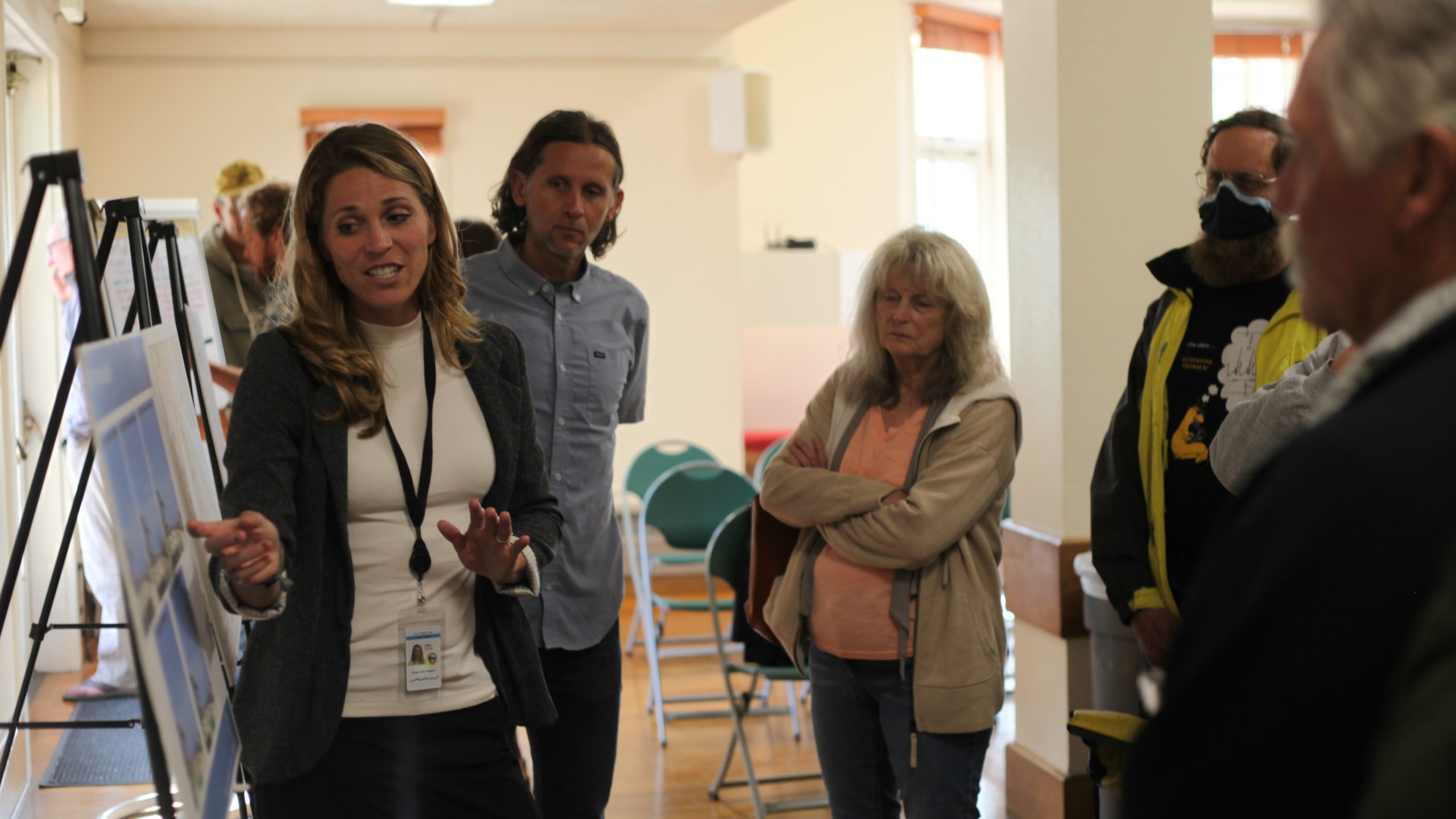
Santa Cruz Transportation Planner Claire Gallogly shares potential projects on West Cliff Drive at an April 27 meeting at London Nelson Community Center in Santa Cruz. (Michael Warren Mott — Santa Cruz Local)
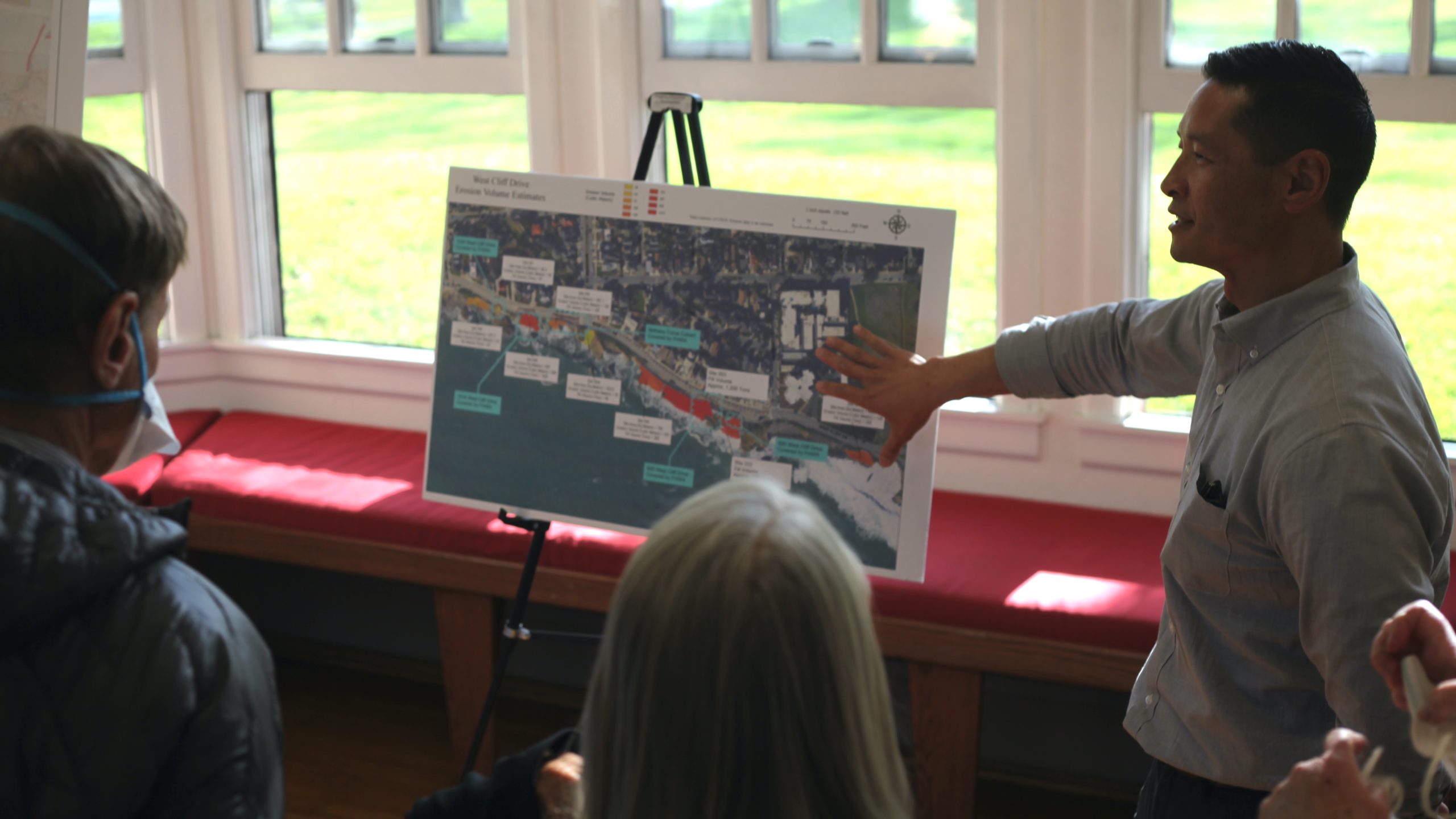
Santa Cruz Public Works Director Nathan Nguyen, right, says city workers are repairing parts of West Cliff Drive with planned reimbursement from state and federal authorities. Nguyen spoke during an April 27 meeting at the London Nelson Community Center. (Michael Warren Mott — Santa Cruz Local)
Emergency repair and traffic updates
Storms in January damaged a culvert under West Cliff Drive at Bethany Curve near Woodrow Avenue, prompting the road to remain closed through April.
- “We’re rebuilding the entire culvert and raising an infill wall on both sides. Later we can tie into a concrete sea wall rather than just rip rap,” said Santa Cruz Senior Civil Engineer Josh Spangrud. Infill walls have concrete on top of the wall. “We found building the infill wall cheaper with less big equipment and trucking. The (Coastal) Commission would like it more as well with a natural-looking finish on it. The road will all come back to (its) original width,” Spangrud said.
- At 1016 West Cliff Drive, some rip-rap rocks have been moved with cranes, Spangrud said. Other rocks have been displaced but in many places they cannot be reset because of equipment and land constraints.
- Spangrud said most engineering projects are expected to last 40-50 years. Most of West Cliff is above sea level, but the culvert at Bethany Curve is not above sea level and could require repairs in less than that time.
- For other work on West Cliff, Public Works staff has been working on an emergency coastal permit to share with the Coastal Commission. “We’re aware of the very serious weather forecasted this winter. We’re racing to get working in summer or fall,” Spangrud said.
- Because of West Cliff Drive detours and increased traffic on Oxford Way, a barrier is expected to be added to Oxford at Bethany Curve “to prevent cut-through traffic,” said Santa Cruz Transportation Planner Claire Gallogly. “We’re continuing to hold meetings in neighborhoods as well,” Gallogly said.
- Other emergency measures included “dumping 280 tons of rock along West Cliff” to replace rocks damaged and displaced during winter storms, said Santa Cruz Public Public Works Director Nathan Nguyen.
Nguyen estimated the total storm-damage repairs will cost $17 million. The Bethany Curve-area damages alone are expected to cost $9 million.
The Federal Highway Administration is expected to cover the emergency repairs if they finish within nine months of the damage. After that time, the administration could cover 87.5%, Nguyen said.
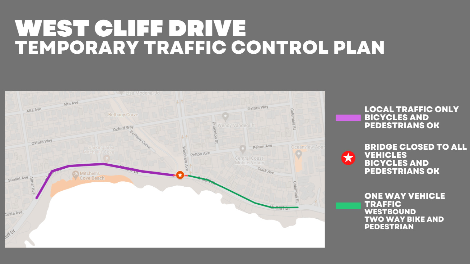
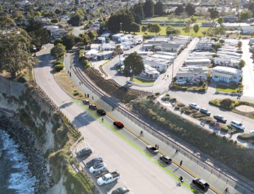
Since February there has been one-way vehicle traffic on West Cliff Drive from Columbia Street to Woodrow Avenue. (City of Santa Cruz)
Traffic flow and transportation changes
Several options remain for parking and traffic flow on West Cliff Drive, said Santa Cruz Transportation Planner Claire Gallogly.
- West Cliff as it currently exists with parking.
- Two-way traffic with no parking.
- One-way traffic with parking.
- A promenade for walkers and cyclists without cars.
- One-way with wide area for walkers and cyclists and a linear park.
“Each of these things can be great. Each loses something. And we could do something different for each part of West Cliff,” Gallogly said.
“We don’t have a predetermined outcome or plan. We need your feedback on what you like and don’t like,” she said. “You’ll also see hoses on the ground collecting data on how many people walk, drive or bike. If you didn’t already know, you’re being tracked on your smartphones: We’re also using smartphone data to see how traffic changed before and after the storms.”
An update on data collection around West Cliff is expected at the May 23 city council meeting. After public input and data collection this summer, the city’s transportation team is expected to make recommendations for a fall city council decision on West Cliff’s future traffic flows of cars, bikes and people.
At Thursday’s meeting, a participant asked if electric bikes, scooters and similar vehicles could be banned. Gallogly said electric bikes are allowed on multi-use paths by state law.
Residents said some people don’t feel safe with bikes; while bikers don’t feel safe on the road.
“It’s so unsafe for pedestrians with people on bikes and electric bikes. I’ve lived here 40 years and I feel unsafe. I also want to bike and be safe,” said Karen Warren.
Asked how the traffic changes are going, Gallogly said feedback was good except for some neighborhood spill-over, which they are addressing piece-by-piece.
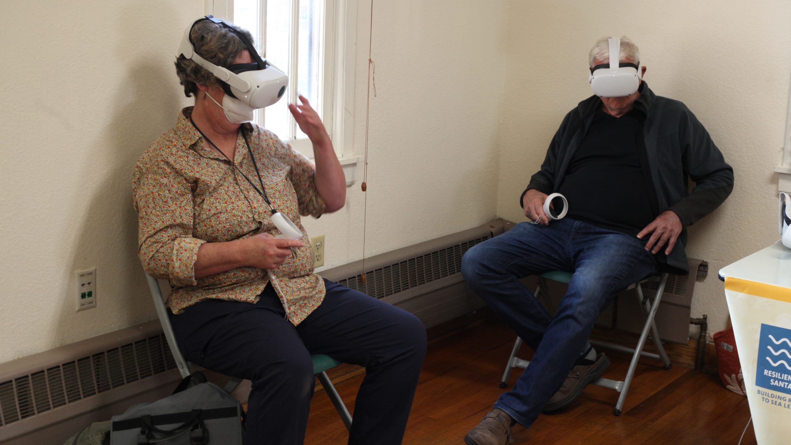
Karen Warren, left, and Yossi Vinograd engage in a virtual reality presentation during a meeting about West Cliff Drive at the London Nelson Community Center on April 27. The Sea Level Rise Explorer program is available on cellphones, computers, Oculus devices and in Spanish and English. (Michael Warren Mott — Santa Cruz Local)
Seeking money outside Santa Cruz
Michael McCormick, president of Sacramento-based consultant Farallon Strategies, led the next session and discussed how the group is helping the city apply to funding from state and federal agencies.
After the emergency repairs and federal reimbursement, next are large grants and philanthropy for longer-term projects.
“There will be more disasters in the future. We’re working to leverage those to support changes; it’s been really dangerous what we’ve been through,” McCormick said.
By the end of June, Farallon consultants plan to integrate and compile city documents and policies to tell the story of West Cliff to access state and federal grants including over 100 engagement activities city leaders held with residents to create prior documents. The consultants also plan to support an ongoing Local Coastal Plan update for the Coastal Commission.
McCormick said there is a lot of money out there available for projects.
“The federal government is deploying a lot of funding for emergencies, climate change and flooding. The state has been a previous source of a lot of money but is now likely less,” McCormick said.
City staff already has applied for several million dollars, he said.
“We can also access the region’s disaster declaration as well as the statewide disaster declaration,” McCormick said.
Next steps
Tiffany Wise-West, the city’s sustainability and climate action manager, said city staff plan to update the transportation actions and next steps in a recovery roadmap in June.
Kahn, the Coastal Commission district manager, said some projects might require commission approval and others might not. The commission has approved a Local Coastal Program that essentially guides development in Santa Cruz’s coastal zone.
“We’ve had a great dialogue with the city. It would be great to hear what the city wants and what’s consistent with the Coastal Act. Anything the city would submit and want to be part of the Local Coastal Program, that would require Commission approval,” Kahn said. But the city already has a certified [Local Coastal Program], so most projects could be under the city’s permit but also would be appealable to the Commission. “If there is additional rock within the actual water, that would require a coastal permit.”
He added it was a complex area with many issues to consider. Portions of the protection could also be “living shoreline,” rather than armoring, where a protected, stabilized coastal edge is made from natural materials such as plants, sand or rock, which could grow over time rather than seawalls or hard structures which impede growth.
Wise-West said the West Cliff Drive Adaptation and Management Plan in 2021 was developed originally to help streamline maintenance on West Cliff. However, after a recent informal review by Coastal Commission staff, Coastal staff said they needed more detail and specificity and may want to see things in a different format, she said.
Wise-West said a grant study would be done later this year and the beginning of next year on different types of coastal protection.
“It’s all up for discussion, what is the right balance of armoring with other potential strategies. We also need more info on nature-based solutions to understand what’s feasible,” she said. “That was a study called out in the West Cliff Drive Adaptation and Management Plan and will be funded by a state grant we’re applying for.”
As for the 2021 plan, she said the city may implement it through coastal development permits rather than a full Commission approval.
“We realized we’re not in complete alignment with them on that but also don’t have complete info they need, so the next steps is studies and figuring out the right format,” she said. “It’s unclear whether we’ll come back to the commission or not and in what format,” Wise-West said. “Sorting that out will happen after the emergency coastal development permits, roadmaps and local coastal program amendment.”
“That gives us the time to have more engagement. Since after what’s happened on West Cliff, people’s opinions may have changed,” Wise-West said.
Save West Cliff
More than 550 people have joined a group called Save West Cliff that is involved in planning for the road and coast.
Some of its leaders have said they want to broaden the conversation beyond one-way or two-way car traffic on West Cliff. Many members want a more holistic picture for the future of West Cliff that includes the surf breaks, beach access, the bike path, other recreational uses and an appreciation of West Cliff’s history.
One of the group’s leaders, former Santa Cruz Mayor Hilary Bryant, said the group has been focused on mapping the area past and present.
“We have maps going back to 1931. It’s astonishing the section that’s been impacted, aerial photos over the years. There used to be a significant beach at Mitchell’s Cove that provided protection as well as reef-like structures where Sabre Jets is now. And at Woodrow and Columbia, there used to be a rock barrier catching all the sand,” Bryant said. “You can see the protection by these natural features gets smaller and smaller, then in big floods in 1982-84 the coastline got hit back-to-back by El Nino years, it just disappears,” Bryant said.
“Once that natural protection went away, the damage really accelerated to the point we’re seeing today,” Bryant said.
Bryant said the group is looking to inform residents and for action on West Cliff.
“We can’t continue to stay in the planning phase,” Bryant said. “There has to be some decisions made and they’re going to have to come sooner than later.”
How to get involved
To provide feedback on the current traffic controls, read related plans and documents, visit the city’s West Cliff page.
Read more:
- One-way West Cliff Drive pilot advances in Santa Cruz — Feb. 28, 2023
- Coastal Commission staff outlines hopes for West Cliff plan — Feb. 10, 2023
- West Cliff Drive traffic meeting on tap — Jan. 27, 2023
- Plans emerge to revive Downtown Santa Cruz, reshape West Cliff Drive — April 27, 2021
- Santa Cruz aims for new approaches to West Cliff Drive erosion — Dec. 3, 2020
Questions or comments? Email [email protected]. Santa Cruz Local is supported by members, major donors, sponsors and grants for the general support of our newsroom. Our news judgments are made independently and not on the basis of donor support. Learn more about Santa Cruz Local and how we are funded.
Michael Warren Mott is a graduate of UC Santa Cruz and Columbia University's School of Journalism. He has worked for newspapers across California.


