Santa Cruz Local offers its news stories free as a public service. We depend on people like you to chip in $9 a month or $99 a year so vital information can be available to all. Can we count on your help?
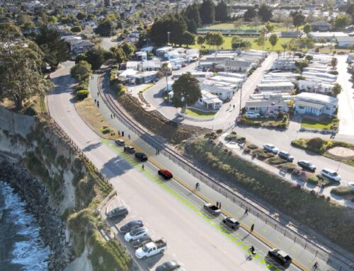
SANTA CRUZ >> Two years of research and community input are expected to culminate this month with the release of two draft plans to deal with storm-driven coastal erosion and anticipated sea-level rise along West Cliff Drive, Santa Cruz Main Beach and Seabright State Beach in Santa Cruz.
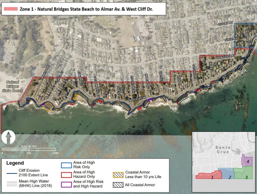
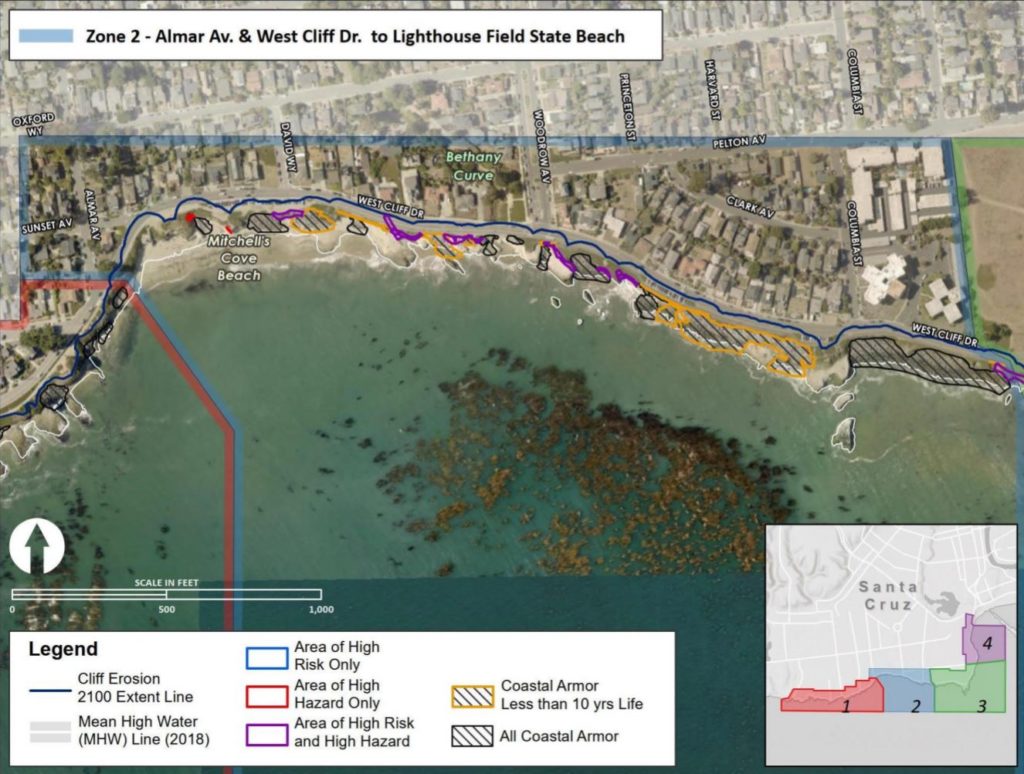
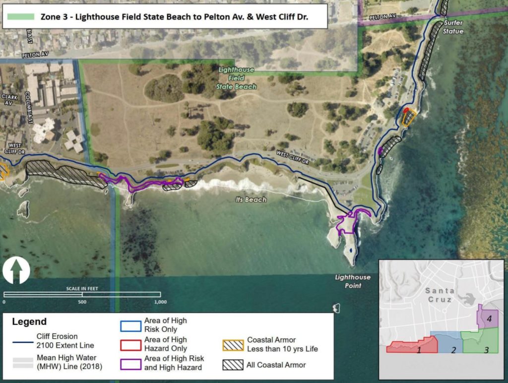
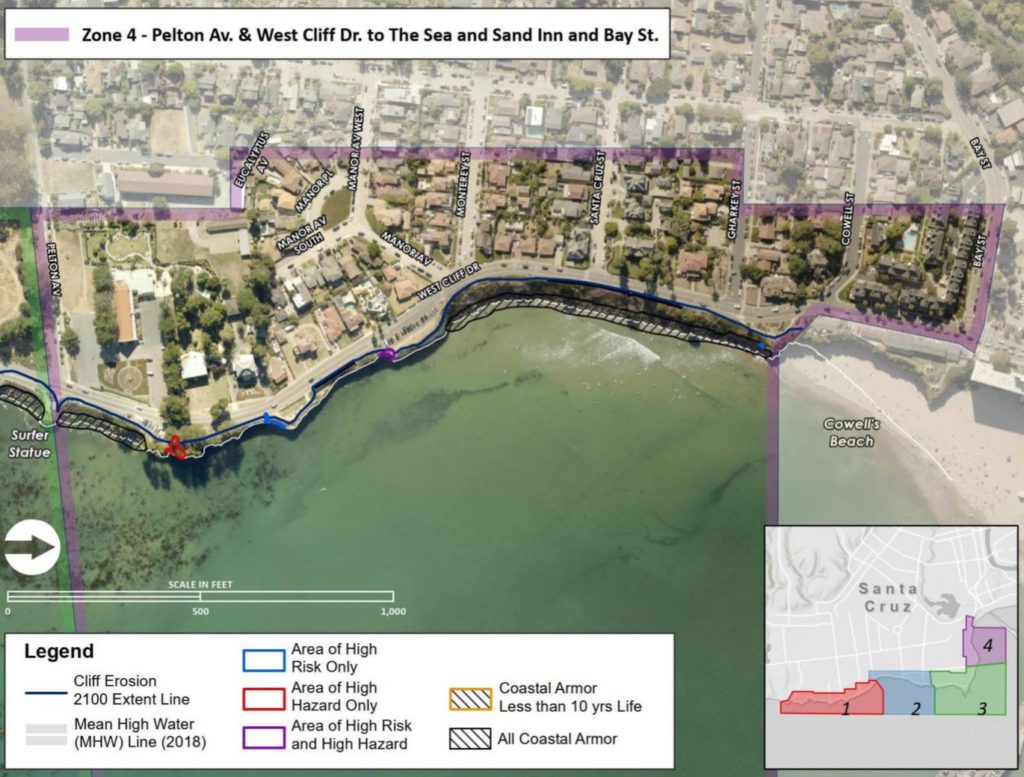
Rather than continue with reactive repairs along West Cliff Drive where the ocean has worn down cliffs, deepened caves and created sinkholes, the West Cliff Drive Adaptation and Management Plan essentially tries to give residents, city leaders and the California Coastal Commission an overarching framework of where re-armoring should take place and where erosion could be managed.
It also tries to inform residents about coastal vulnerabilities. The plan addresses strategies for the next five to 10 years.
A second plan, which is an update to the Local Coastal Program for the California Coastal Commission, includes areas beyond West Cliff Drive such as Cowell and Main beaches and Seabright State Beach. Local Coastal Programs guide development and can set land use plans and zoning. Santa Cruz County leaders also recently brought a program to the Coastal Commission that dealt with beachfront homes.
Public engagement, research and presentations have been done together under the title Resilient Coast Santa Cruz. City of Santa Cruz Sustainability and Climate Action Manager Tiffany Wise-West has spearheaded the project.
“This is really the starting point for having these conversations,” Wise-West said in an interview this week. “What do we want the coastline to look like so it is equitable for everyone?”
Wise-West also has worked closely with Coastal Commission staff because the Coastal Commission eventually is expected to approve the plans. In part because of unpermitted seawalls, the Coastal Commission has asked city of Santa Cruz leaders for a West Cliff plan since the 1980s.
The West Cliff Drive draft plan has several parts:
- Large boulders, called rip-rap, have toppled on many beaches, and the plan calls to restack them in many places.
- There is a conceptual plan for public bathrooms to be built on Bethany Curve on the inland side of West Cliff Drive.
- The plan includes stormwater fixes, trail and overlook improvements and minor transportation changes.
- Maps show potential “managed retreat” at places such as the 20-minute overlook parking lot at Natural Bridges State Beach. However, Wise-West said such plans are beyond the 10-year scope of the project and would have to be approved by State Parks. The draft plan to be released this month may include more details on areas of retreat.
- It also includes a potentially grant-funded feasibility study suggested by a consultant to pump sand to the ocean from Pyramid Beach just east of Natural Bridges State Beach. The sand could come from the San Lorenzo River or the dredge at the Santa Cruz Small Craft Harbor, Wise-West said, and currents would take the sand to beaches such as Mitchell’s Cove, Its and Cowell’s. Many questions remain about funding, Monterey Bay Marine Sanctuary restrictions and surf impacts, among other things.
The second plan is the Local Coastal Program update. That plan is similar to the West Cliff plan’s scope, but it includes the rest of the city of Santa Cruz shore and Seabright State Beach. Both plans are part of the city’s Resilient Coast project.
- The Local Coastal Program update includes three potential plans for Seabright State Beach. There has not been consensus on which plan to pursue and State Parks leaders have not yet expressed a preference.
- Maps show ideas for low-lying areas such as Beach Street and Beach Flats.
The plans are needed because coastal erosion — particularly from “episodic events” like El Nino winters, king tides, storm surges and large waves with king tides — has toppled cliffs along West Cliff Drive repeatedly in the past 50 years, according to a Existing Conditions Inventory produced in the Resilient Coast project.
“In Santa Cruz, sea levels are projected to rise 4 inches by 2030, 28 by 2060 and 68 by 2100,” according to a Resilient Coast document. “Even if we cut our carbon emissions significantly, coastal change will be unavoidable. By proactively planning for these changes, we will best utilize our time and energy. Examples of adaptation include limiting development in flood zones, requiring safer building codes for coastal construction, or moving roads away from vulnerable areas,” the document states.
Rather than plan for, say, a seawall to be built in 2050, Wise-West said, the West Cliff plan uses “physical triggers” to gauge how much of the cliffs have eroded, then make changes.
“Typical” sea-level rise projections are 5.2 feet by the year 2100 and up to 10 feet in some projections, Wise-West said. “There’s no real surprises to the areas where the impact will be. For flooding, it’s the low-lying areas. For erosion, it’s the cliffs. We know where things will happen, it’s a question of when.”
One problem pointed out in the research is the lack of a permanent water-level recorder to gauge and predict tides and sea level in Santa Cruz. The closest recorder is in Monterey, according to the Existing Conditions Inventory. The report recommends the installation of a gauge in Santa Cruz.
Representatives of several government agencies are coordinating to try to install a recorder, Wise-West said Thursday.
The two reports are due in draft and final versions in the coming weeks.
- Late December: The West Cliff Drive Adaptation and Management Plan and the separate draft of the Local Coastal Program Amendment for the California Coastal Commission are expected to be released.
- Late January 2021: Both plans’ final versions are expected to be released.
- February: Santa Cruz City Council is expected to hold hearings on the plans.
- March: Santa Cruz City Council could adopt the plans.
Learn more and weigh in on the city’s Resilient Coast Santa Cruz page.
Stephen Baxter is a co-founder and editor of Santa Cruz Local. He covers Santa Cruz County government.

